Researchers at Hanyang University have unveiled a new unmanned aerial vehicle (UAV) system designed to monitor power transmission lines, a move that could transform the maintenance of critical infrastructure.
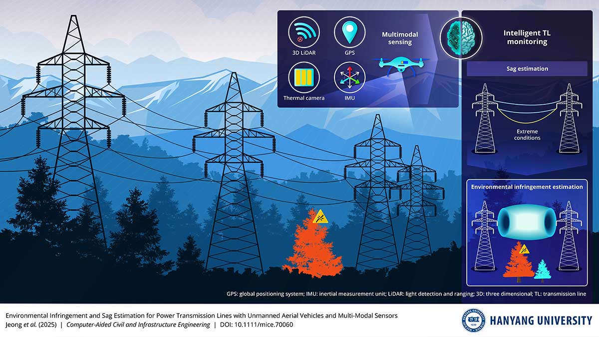
The approach, which integrates multiple sensors including 3D LiDAR, GPS, inertial measurement units and thermal cameras, allows for simultaneous assessment of line sag and environmental infringement.
Power transmission lines span diverse and often remote landscapes, from forests and agricultural areas to mountainous regions. Their upkeep has traditionally required on-site inspections, which can be time-consuming, costly and sometimes hazardous. The Hanyang team’s method promises to automate much of this monitoring, offering predictive insights into how lines behave under variable operating conditions.
The research, led by Ki-Yong Oh, Associate Professor of Mechanical Engineering, and PhD candidate Munsu Jeon, presents the first UAV-based system capable of evaluating both sag and encroachment risks across the full span of transmission lines. The findings were first made available online on 1 September 2025 and published in the journal Computer-Aided Civil and Infrastructure Engineering on 20 October 2025.
Using multimodal data, the system reconstructs the geometric profile of transmission lines and measures sag under real operating conditions. Thermal imaging is used to map line temperature, enabling the team to assess how lines might deform under extreme heat, heavy load or other environmental stresses. The system then calculates “infringement zones” by comparing sag profiles with the surrounding landscape, producing metrics such as intrusion depth and affected length to prioritise maintenance.
“Our technology supports routine monitoring in areas where vegetation growth, uneven terrain or nearby structures increase the risk of contact with transmission lines,” Prof. Oh said. “It also allows us to predict how lines would behave under higher temperatures, heat waves, or abnormal climate events without additional on-site instrumentation.”
By providing early warnings of potential interference, the UAV platform enables operators to schedule targeted vegetation management, reinforce vulnerable sections, and reduce the need for repeated field inspections. The approach could also be adapted to other infrastructure where deformation and environmental interaction must be monitored.
“As automated monitoring becomes more widespread, similar methods could be applied to other hard-to-access infrastructure,” Mr. Jeon said. “This approach allows inspections to evolve from reactive checks to preventive management, strengthening the resilience of critical systems over time.”
The development reflects a broader shift towards predictive infrastructure management, combining robotics, AI, and advanced sensing to reduce operational risk and improve efficiency.
There’s plenty of other editorial on our sister site, Electronic Specifier! Or you can always join in the conversation by visiting our LinkedIn page.