
Advanced Navigation has successfully demonstrated a breakthrough in underground navigation, delivering high-precision positioning without needing fixed infrastructure or GNSS, in Europe’s deepest underground mine in Pyhäjärvi, Finland.
The hybrid navigation system, combining a Laser Velocity Sensor (LVS) with the Boreas D90 fibre-optic gyroscope (FOG) Inertial Navigation System (INS) achieved consistent sub-0.1% navigation error across multiple runs without relying on fixed positioning infrastructure, pre-existing maps, or external aid.
“Unreliable navigation underground isn’t a minor technical constraint – it’s a major operational bottleneck,” said Joe Vandecar, Senior Product Manager, Advanced Navigation. “Maintaining precision over a 22.9km subterranean course in Europe’s deepest underground mine demonstrates a level of performance that few systems in the world can rival without any prior intelligence of the environment. These results prove we’re one step closer to unlocking scalable underground autonomy.”
Navigating the underground network of the Pyhäsalmi Mine has a number of challenges. It is located 1.4km underground with a 63 degree latitude. The mine is impervious to GNSS signals and its repetitive, multi-level tunnel network creates a high risk of visual disorientation. Its metallic ores distort magnetic fields and scatter radio waves.
To overcome these challenges, mines usually depend on infrastructure-heavy solutions like ultra-wideband beacons, Wi-Fi, 5G repeaters, or perception-based techniques such as Simultaneous Localisation and Mapping (SLAM) which require cameras.
These methods can be costly to integrate and maintain, slow to install, and can become unavailable in hazardous or unmapped zones where reliable navigation is important. Shifting to a resilient navigation system with less dependency on infrastructure provides a scalable alternative.
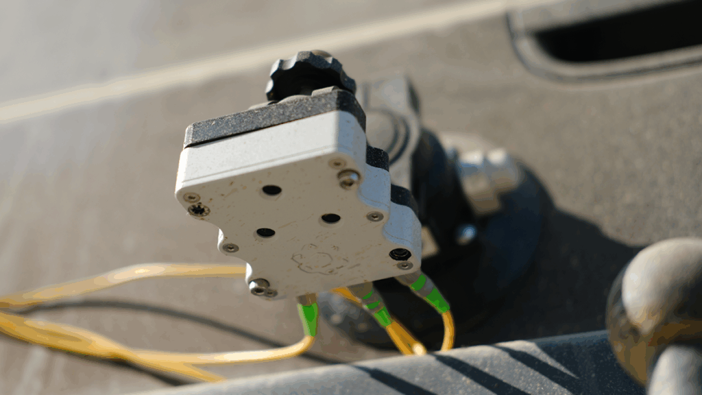
Championing this architecture, the hybrid navigation system is centred on Boreas – a world-class FOG INS. Unlike conventional systems, Boreas doesn’t rely on GNSS or magnetic compasses. Instead, it uses ultra-sensitive FOG technology to detect the Earth’s rotation and determine true North, a process known as gyrocompassing to find the vehicle’s direction (heading).
To maintain and enhance this accuracy, the INS is merged with Advanced Navigation’s LVS. Using infrared lasers, LVS continuously measures the vehicle’s true 3D velocity relative to the ground. This real-time data is crucial for correcting the gradual ‘drift’ that occurs in standalone inertial systems, enabling the Hybrid System to maintain precision over extended distances.
“We were thoroughly impressed by the results the sensor fusion provided. I have used and been exposed to these sorts of sensors in other projects, and nothing has come close to this level of performance. It’s clear the Laser Velocity Sensor is a major key in providing these outstanding results,” stated Magnus Zetterberg, Senior Consultant, Combitech, who observed the demonstration.
There’s plenty of other editorial on our sister site, Electronic Specifier! Or you can always join in the conversation by visiting our LinkedIn page.